Making Tracks
/
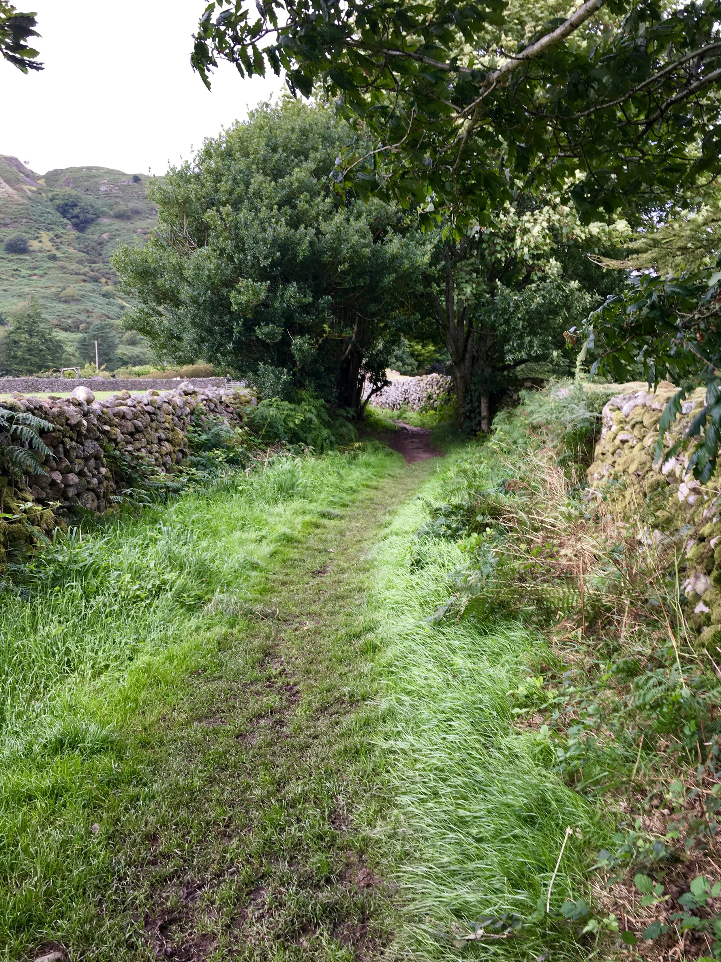
green lanes of the KENtmere valley
Having just discovered my first lonning in Cumbria last week, I though I'd look into old trackways a little more and it turns out to be a vast network; in fact the United Kingdom is crisscrossed with ancient paths and tracks.
As well as the longer, more well known paths, there are hundreds of small, secret, almost forgotten pathways that go by many different names: holloways, green lanes, barfs, sunken lanes, greenways, trods, byways, driftways, lonnens, loanins, lonnings, lons, droveways, pilgrimage routes, miners paths, trading paths, packhorse routes, reivers roads, military roads, turnpikes, shieling paths, boreens, bealachs, casans, smugglers paths, timber trackways, corduroy trackways, herepaths, herewags, heargways, toghers, slighes, ridgeways, watershed routes and many more

Huntingstile Lonning, Grasmere
TICKLE BELLY alley lonning, boot

ticklebelly alley
Many follow the natural contours of the landscape; rivers, ridges, valleys; perhaps more solid ground or firmer sand, over mountain passes and through marshy or boggy ground and to fording points of rivers and streams. Many have neolithic origins such as The Ridgeway which was in use 5000 years ago or the Sweet Track which is perhaps 5800 years old. Some are Saxon, some Celtic, lots are Roman such as the Fosse Way or Watling Street and were built over older trackways, some are medieval - the Long Causeway - and some are later still; 17th or 18th century such as the Keighley and Kendal Turnpike or the Sparrow Herme Turnpike.
However, these routes, which also include the Corlea Trackway, Icknield Way, Harrow Way, Pilgrim's Way, Mariner's Way, Saints Way, the Old Way, Broomway, Kennet Avenue, Ermine Street, Dere Street, the Peddars Way and the Devil's Causeway were all well used. The green lanes or lonnings or holloways were more rural; used for driving livestock, travelling between settlements, or were eroded by water, marked boundaries between two landowners and some do date back to the Romans and Iron Age.
Sunken lanes are characterised by quite steep sides and hedgerows, packhorse routes tend to be narrower, drovers routes are wide, trods are fairly indistinguishable, barfs are quite steep and green lanes were unpaved and sometimes only known to locals.

green lanes of the KENtmere valley
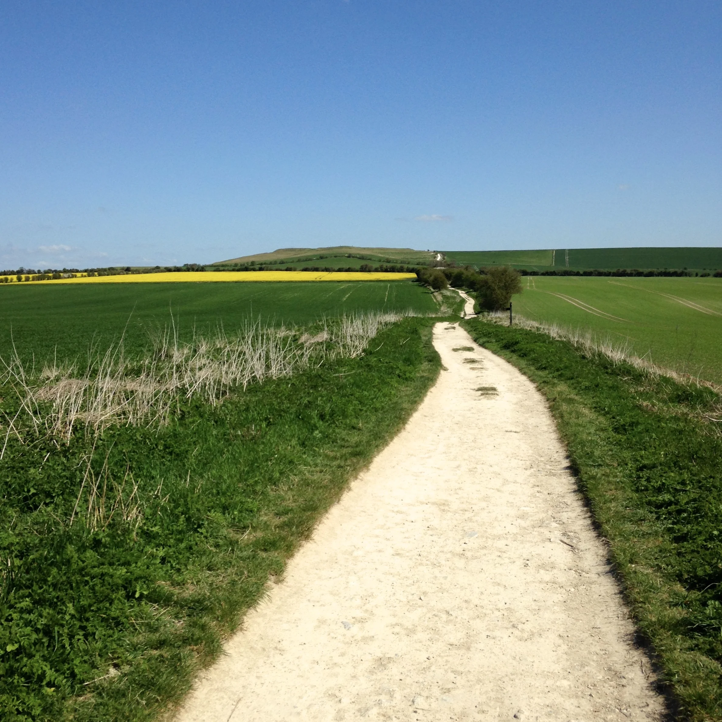
the Ridgeway
What is sad today, is that a lot are disappearing; either through a lack of use and have become too overgrown, some are being upgraded to byways, some have become proper roads, hedgerows have being grubbed up to make way for larger fields and these beautiful little corridors through the landscape have been lost - occasionally just a rut in the landscape is all that's left.
Let's not lose them. Let's search them out and use them. Let's listen to Joni Mitchell and not go down the 'pave paradise, put up a parking lot' route; there are hundreds of better paths to choose.

old woodland paths

a path or a burrow?!